Ferry Road etc
Introduction
The street now known as Ferry Road was referred to in various ways in the past, old maps showing ‘Road from Queensferry’, ‘Queensferry Road’ and so on, but it seems to have been described as Ferry Road by the middle of the nineteenth century. For most of its length it forms part of the A902, with a section at the west (Davidson’s Mains) end being part of the B9085.
Although the whole route is known as Ferry Road, sections also have ‘side names’, or had these in the past.
This page focuses on Ferry Road itself and streets to the north of it between Craighall Road and Davidson’s Mains – other streets are outside the area this website aims to cover.
Map
Ferry Road
Buildings on Ferry Road include St Serf’s Church, Inverleith Parish Church, Oaklands School and Holy Cross Primary School. Also formerly on Ferry Road were the Northern General Hospital (now the site of Morrison’s supermarket) and Holy Cross Academy.
Ferry Gait Crescent
Ferry Gait Drive
Ferry Gait Walk
These three streets, off Ferry Road between Muirhouse and Silverknowes, were built between 2007 and 2010 approximately.
Ferry Road Avenue
Ferry Road Drive
Ferry Road Gardens
Ferry Road Grove
Ferry Road Place
For details of these five streets please see the West Pilton page.
Ferryfield
This street dates from 1982, and, like West Winnelstrae is on part of the site of a large farm called Windlestrawlee (or Winnelstraelee). The former farmhouse can be seen on the 1933 street map.
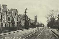
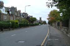
Inverleith Gardens
This name applies to a short section of Ferry Road, west of Goldenacre.
West Ferryfield
This street is immediately west of Ferryfield.
West Winnelstrae
This street dates from 1981, and, like Ferryfield, is on part of the site of Windlestrawlee (or Winnelstraelee), which can be seen on the 1933 street map.
Other names
Side names include Bangholm Villas.
.Other streets
Ferry Road Avenue, Ferry Road Gardens, Ferry Road Drive, Ferry Road Grove, Ferry Road Lane and Ferry Road Place are dealt with on the West Pilton page.

